
1. Introduction


Latitude and longitude form the geographical coordinate system, a global framework used to precisely locate any place on Earth. This system divides the Earth into an imaginary grid of horizontal and vertical lines, allowing geographers, navigators, scientists, and everyday users to determine exact positions.
Without this coordinate system, modern navigation, mapping, aviation, shipping, and even smartphone GPS systems would be impossible. Latitude and longitude are fundamental tools that connect geography with real-world applications like disaster management, urban planning, and global communication.
🌐 2. Concept of Geographical Coordinates
2.1 What Are Coordinates?
Geographical coordinates are numerical values that specify the position of a point on Earth’s surface using:
- Latitude (north-south position)
- Longitude (east-west position)
Together, they create a grid system over the Earth.
2.2 Importance of the Coordinate System
- Precise location identification
- Essential for navigation (GPS, ships, aircraft)
- Helps in mapping and surveying
- Used in weather forecasting and climate studies
- Supports geospatial technologies (GIS, Remote Sensing)
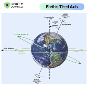
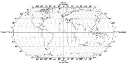
🌏 3. Latitude
3.1 Definition of Latitude

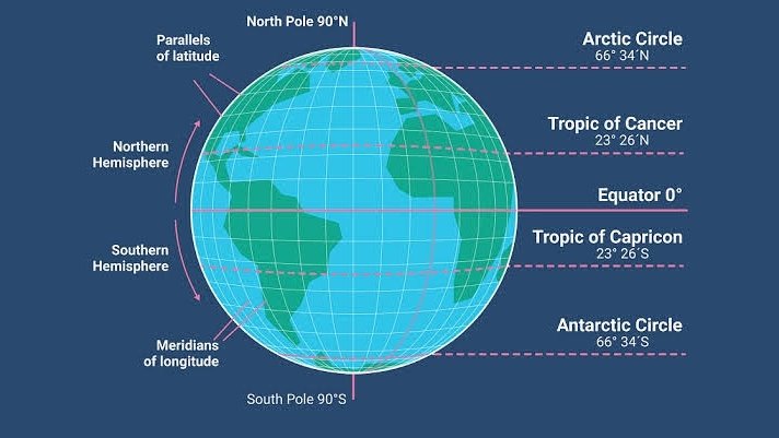
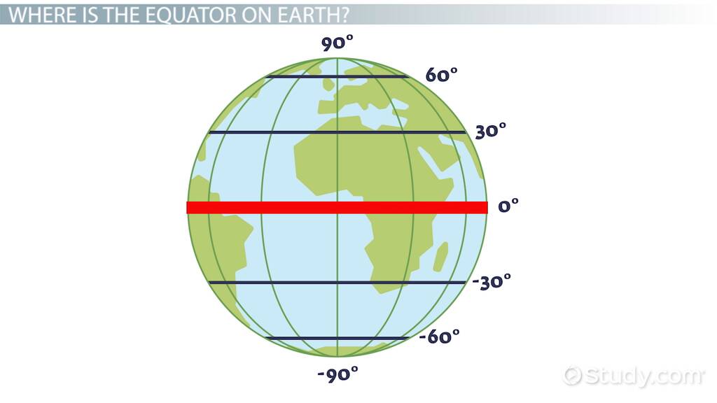
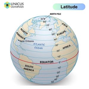
Latitude refers to the angular distance of a place north or south of the Equator, measured in degrees.
- Represented by horizontal lines (parallels)
- Measured in degrees (°), minutes (‘), seconds (“)
- Range: 0° to 90° North and South
3.2 Important Parallels of Latitude
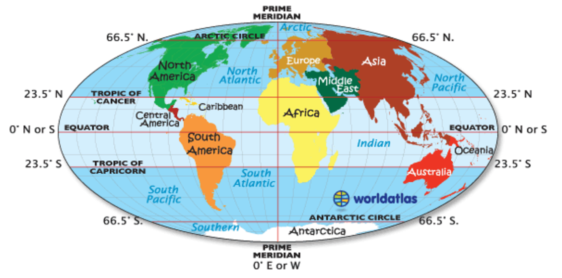

Major Latitudes:
- Equator (0°)
- Divides Earth into Northern and Southern Hemispheres
- Receives maximum sunlight
- Tropic of Cancer (23.5° N)
- Northern limit of direct sunlight
- Tropic of Capricorn (23.5° S)
- Southern limit of direct sunlight
- Arctic Circle (66.5° N)
- Region of midnight sun
- Antarctic Circle (66.5° S)
- Polar day/night phenomena
3.3 Characteristics of Latitude
- Parallels never meet
- Decrease in size toward poles
- Equal distance between lines
- Influence climate and temperature
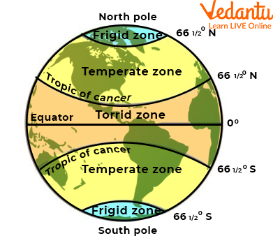
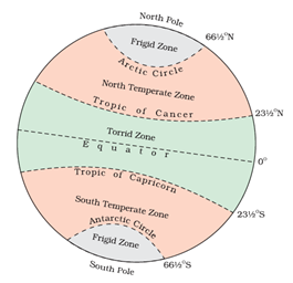
3.4 Heat Zones of the Earth

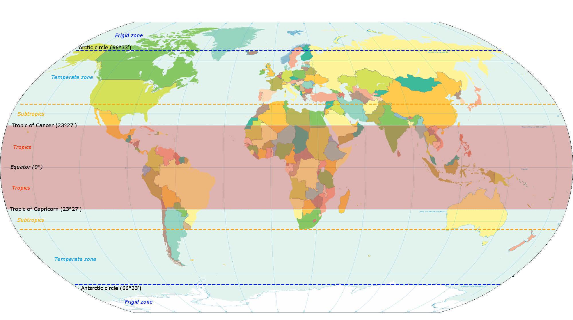
Based on latitude, Earth is divided into:
a) Torrid Zone
- Between Tropics
- Hot climate
b) Temperate Zone
- Between Tropics and Polar Circles
- Moderate climate
c) Frigid Zone
- Near poles
- Extremely cold
🌍 4. Longitude
4.1 Definition of Longitude


Longitude refers to the angular distance east or west of the Prime Meridian.
- Represented by vertical lines (meridians)
- Range: 0° to 180° East and West
4.2 Prime Meridian
- Located at Greenwich, London
- Divides Earth into:
- Eastern Hemisphere
- Western Hemisphere
4.3 Characteristics of Longitude
- Meridians converge at poles
- Equal in length
- Used to calculate time
⏰ 5. Longitude and Time
5.1 Relationship Between Longitude and Time

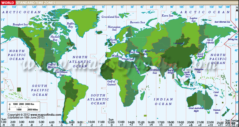

- Earth rotates 360° in 24 hours
- 1 hour = 15° longitude
- 1° = 4 minutes
5.2 Standard Time
- Countries adopt a standard meridian
- Example: Indian Standard Time (IST) = 82.5° E
5.3 International Date Line (IDL)
- Located near 180° longitude
- Date changes when crossing
- Zig-zag to avoid splitting countries
🌐 6. Latitude vs Longitude


| Feature | Latitude | Longitude |
|---|---|---|
| Direction | East-West lines | North-South lines |
| Measure | North/South of Equator | East/West of Prime Meridian |
| Shape | Parallel circles | Semi-circles |
| Function | Climate zones | Time calculation |
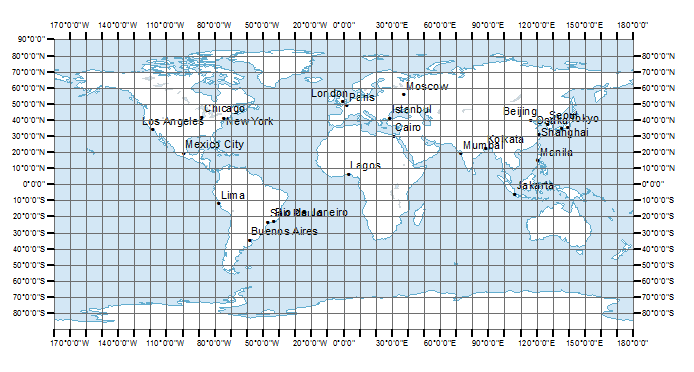
📍 7. Locating Places Using Coordinates
7.1 How Coordinates Work


A location is identified by:
- Latitude first
- Longitude second
Example:
28.61° N, 77.23° E → Delhi
7.2 Grid System
- Intersection of latitude and longitude lines
- Forms a global reference system
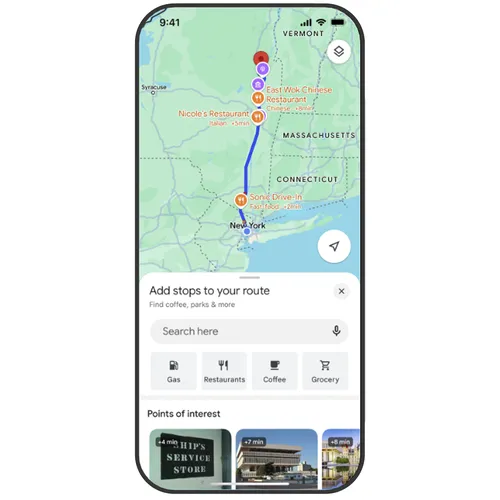
🛰️ 8. Applications of Latitude & Longitude
8.1 Navigation


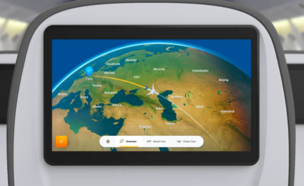
- Used in GPS systems
- Essential for ships and aircraft
8.2 Mapping and Surveying
- Accurate map creation
- Land measurement
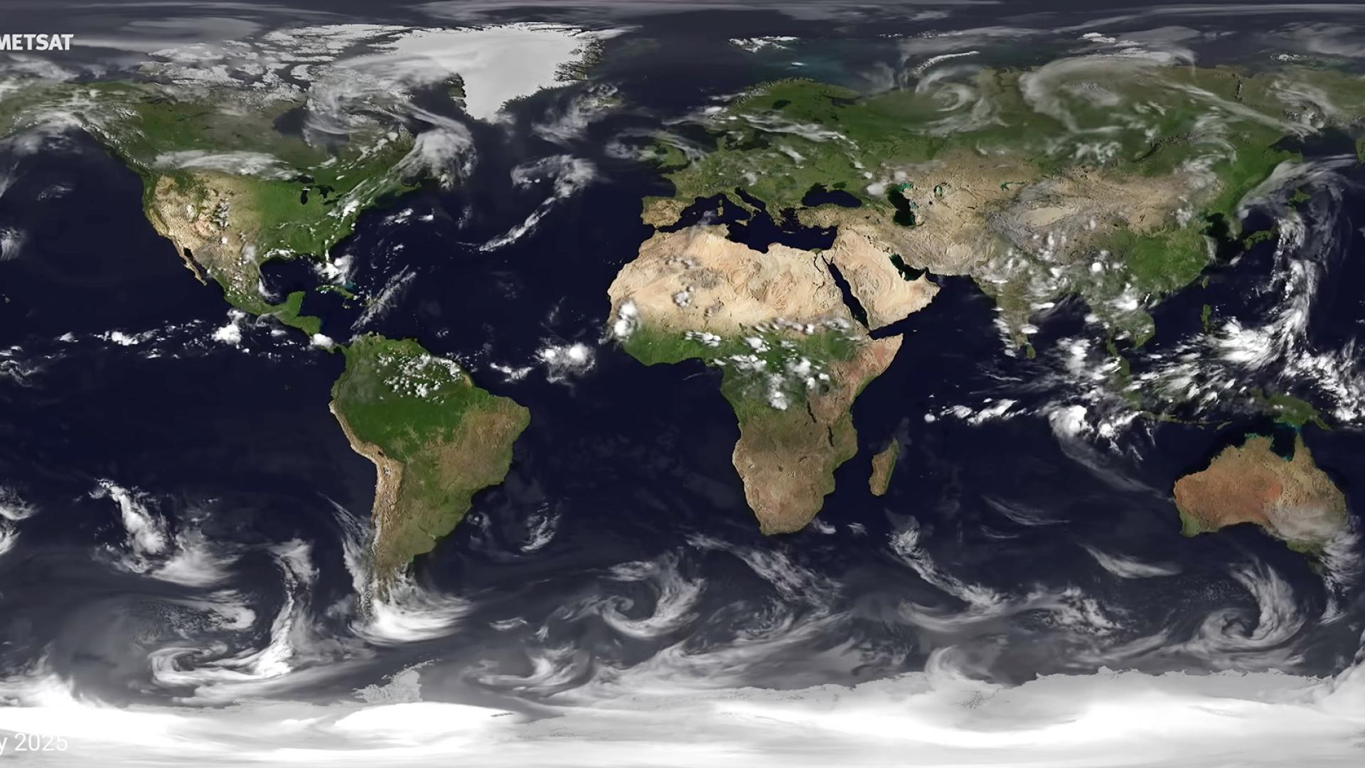
8.3 Weather and Climate
- Climate zones based on latitude
- Weather tracking using coordinates
8.4 Disaster Management
- Locating disaster zones
- Coordinating rescue operations
8.5 Military and Defense
- Strategic location tracking
- Missile targeting systems
🌌 9. Advanced Concepts
9.1 Geodetic vs Geographic Coordinates
- Geodetic considers Earth’s shape
- Geographic uses simplified models
9.2 GPS (Global Positioning System)
- Satellite-based navigation
- Provides real-time coordinates
9.3 GIS (Geographic Information System)
- Combines spatial data with analysis
- Used in urban planning, environment
⚖️ 10. Importance in Daily Life

Latitude and longitude affect:
- Travel and navigation
- Weather prediction
- Communication systems
- Online maps and apps
- Global trade
🧠 11. Conclusion
Latitude and longitude together form the backbone of geographical understanding. They transform the Earth into a measurable and navigable space, enabling humans to explore, map, and manage the planet efficiently.
From ancient navigation to modern GPS technology, this coordinate system has remained essential. It not only helps in locating places but also plays a crucial role in climate science, global communication, and technological advancement.
Understanding latitude and longitude is fundamental for anyone studying geography, as it lays the groundwork for more advanced topics like cartography, GIS, and spatial analysis.