Category Archives: Uncategorized

🌱 Meaning and Nature of Human Values — A Comprehensive Detailed Study


🌍 Introduction to Human Values

Image
Image
Image
Image

Human values are the fundamental beliefs, principles, and standards that guide human behavior, decisions, and interactions. They represent what individuals and societies consider important, desirable, and worthwhile in life. These values influence how people think, act, and relate to others, forming the foundation of ethical conduct and social harmony.

At their core, human values define what is right and wrong, good and bad, acceptable and unacceptable. They shape personality, character, and identity, and play a crucial role in creating a peaceful and sustainable society.

Human values are not just abstract ideas; they are lived experiences reflected in everyday actions such as honesty, kindness, respect, and responsibility. They help individuals make meaningful choices and lead a purposeful life.


🧭 Meaning of Human Values


🔹 Definition of Human Values

Human values can be defined as:

“Enduring beliefs or principles that guide behavior, influence decision-making, and help individuals distinguish between right and wrong.”

These values act as internal guides or moral compasses that direct human actions toward desirable goals.


🔹 Key Aspects of Meaning

1. Guiding Principles

Human values serve as standards for behavior, helping individuals decide how to act in different situations.

2. Basis of Judgment

They enable individuals to evaluate actions, ideas, and situations as good or bad.

3. Social Relevance

Values are shared within societies and contribute to social order and harmony.

4. Personal Significance

They are deeply rooted in individual beliefs and experiences.


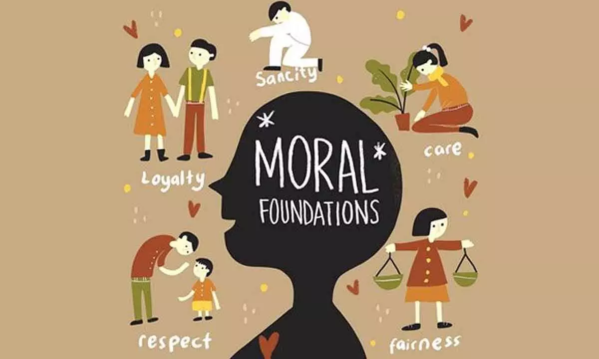
🔹 Examples of Human Values

  • Honesty
  • Integrity
  • Respect
  • Love
  • Compassion
  • Justice
  • Responsibility
  • Cooperation
  • Tolerance
  • Kindness

🌿 Nature of Human Values

The nature of human values refers to their characteristics, features, and inherent qualities that define how they function in human life and society.


🔹 1. Universal Nature

Image
Image
Image
Image

Human values are universal in the sense that they are recognized across cultures and societies.

  • Values like truth, love, and peace are accepted worldwide
  • Promote global harmony

🔹 2. Dynamic and Evolving

Image
Image
Image
Image

Values are not static; they change over time due to:

  • Cultural shifts
  • Technological advancements
  • Social transformations

Example: Changing attitudes toward gender roles.


🔹 3. Learned and Acquired

Image
Image
Image
Image

Human values are not innate but learned through:

  • Family upbringing
  • Education
  • Society
  • Personal experiences

🔹 4. Abstract and Intangible

Image
Image
Image
Image

Values cannot be seen or touched but are reflected in behavior.

  • Exist as ideas and beliefs
  • Manifest through actions

🔹 5. Hierarchical

Image
Image
Image
Image

Values are arranged in order of importance:

  • Some values are prioritized over others
  • Example: A person may value honesty over convenience

🔹 6. Relative yet Absolute

Image
Image
Image
Image
  • Some values are relative (vary across cultures)
  • Some are absolute (universal, e.g., truth, justice)

🔹 7. Goal-Oriented

Image
Image
Image
Image

Values guide individuals toward desired goals:

  • Provide direction in life
  • Help achieve personal and social well-being

🔹 8. Integral to Personality

Image
Image
Image
Image

Values shape:

  • Character
  • Attitudes
  • Behavior

They form the core of an individual’s personality.


🌍 Classification of Human Values


🔹 1. Personal Values

  • Individual beliefs and principles
  • Example: Self-discipline, honesty

🔹 2. Social Values

  • Promote social harmony
  • Example: Cooperation, equality

🔹 3. Moral Values

  • Concern right and wrong
  • Example: Justice, integrity

🔹 4. Cultural Values

  • Derived from traditions
  • Example: Respect for customs

🔹 5. Spiritual Values

  • Related to inner peace and purpose
  • Example: Faith, compassion

🔹 6. Ethical Values

  • Guide professional and social conduct
  • Example: Accountability, fairness

🧠 Importance of Human Values


🔹 1. Personal Development

  • Builds strong character
  • Enhances self-awareness

🔹 2. Social Harmony

  • Promotes peaceful coexistence
  • Reduces conflicts

🔹 3. Ethical Decision-Making

  • Helps in making right choices

🔹 4. Cultural Stability

  • Preserves traditions and identity

🔹 5. Global Peace

  • Encourages understanding and cooperation

⚖️ Human Values vs Moral Values vs Ethics

AspectHuman ValuesMoral ValuesEthics
ScopeBroadSpecificSystematic
NaturePersonal & socialRight & wrongRules & standards
ExampleRespectHonestyProfessional conduct

🌱 Sources of Human Values


🔹 Family

  • First source of value learning

🔹 Education

  • Formal teaching of ethics

🔹 Society

  • Cultural norms and traditions

🔹 Religion & Philosophy

  • Moral teachings

🔹 Media & Technology

  • Influence modern values

🌍 Human Values in Modern Society


🔹 Challenges

  • Materialism
  • Individualism
  • Digital distractions

🔹 Need for Value Education

  • Essential for balanced development
  • Promotes responsible citizenship

🌱 Development of Human Values


🔹 Methods:

  • Value-based education
  • Role models
  • Life experiences
  • Reflection and self-awareness

🌍 Role of Human Values in Sustainable Development

  • Promote environmental responsibility
  • Encourage ethical resource use
  • Support social justice

🧩 Human Values and Emotional Intelligence

  • Empathy
  • Self-regulation
  • Social skills

Values enhance emotional intelligence and vice versa.


🌟 Conclusion

Human values are the foundation of a meaningful and harmonious life. They guide human behavior, shape personality, and ensure social stability. The nature of human values—being universal, dynamic, learned, and goal-oriented—makes them essential for both individual growth and societal progress.

In today’s rapidly changing world, strengthening human values is more important than ever. They help individuals navigate complexities, make ethical decisions, and contribute positively to society. By understanding and practicing human values, we can build a more compassionate, just, and sustainable world.


🏭 Industries & Location Factors — A Comprehensive Detailed Study


🌍 Introduction to Industries

Image
Image
Image
Image

Industries are the backbone of modern economies, transforming raw materials into finished goods and providing employment, income, and economic growth. The study of industries and their location is a crucial part of economic geography, helping us understand why industries are established in particular places and how they influence regional development.

Industrialization has played a transformative role in shaping human civilization, especially since the Industrial Revolution, which marked the shift from agrarian economies to industrial economies. Today, industries range from traditional handicrafts to highly advanced technology-based sectors.


🏭 Meaning and Classification of Industries


🔹 Definition of Industry

An industry is an economic activity concerned with:

  • Extraction of raw materials
  • Processing and manufacturing
  • Provision of services

🔹 Types of Industries

Image
Image
Image
Image

1. Primary Industries

  • Extract natural resources
  • Examples: Agriculture, fishing, mining

2. Secondary Industries

  • Convert raw materials into finished goods
  • Examples: Manufacturing, construction

3. Tertiary Industries

  • Provide services
  • Examples: Banking, transportation, tourism

4. Quaternary Industries

  • Knowledge-based services
  • Examples: IT, research

5. Quinary Industries

  • High-level decision-making roles
  • Examples: Government, top executives

📍 Industrial Location — Concept

Industrial location refers to the geographical placement of industries. It is influenced by various factors that minimize costs and maximize profits.

Industries do not locate randomly; they follow specific patterns based on resource availability, market access, and economic conditions.


⚙️ Factors Affecting Industrial Location


🌍 1. Raw Materials

Image
Image
Image
Image
  • Industries tend to locate near raw material sources to reduce transportation costs.
  • Weight-losing industries (e.g., iron and steel) are usually near raw materials.

🔹 Examples:

  • Iron and steel plants near coal and iron ore deposits
  • Sugar mills near sugarcane fields

⚡ 2. Power and Energy

Image
Image
Image
Image
  • Industries require reliable energy sources.
  • Earlier dependent on coal; now diversified to electricity, oil, gas, and renewables.

🚚 3. Transportation

Image
Image
Image
Image
  • Efficient transport reduces cost of raw materials and finished goods.
  • Industries often locate near ports, railways, and highways.

👷 4. Labour

Image
Image
Image
Image
  • Availability of skilled and unskilled labour is crucial.
  • Labour-intensive industries prefer regions with abundant workforce.

🏙️ 5. Market

Image
Image
Image
Image
  • Industries producing perishable or bulky goods locate near markets.
  • Example: Food processing industries.

💰 6. Capital

Image
Image
Image
Image
  • Investment is required for setting up industries.
  • Industrial regions attract more capital due to better infrastructure.

🏛️ 7. Government Policies

Image
Image
Image
Image
  • Tax incentives, subsidies, and regulations influence location.
  • Example: Special Economic Zones (SEZs).

🌐 8. Technology

Image
Image
Image
Image
  • Advanced technology reduces dependence on raw materials and labour.
  • Promotes location flexibility.

🌿 9. Climate and Environment

Image
Image
Image
Image
  • Certain industries require specific climatic conditions.
  • Environmental regulations affect industrial location.

🏞️ 10. Site and Situation Factors

  • Site: Physical characteristics (land, water, terrain)
  • Situation: Relative location (transport, market proximity)

📊 Theories of Industrial Location


📐 Weber’s Theory of Industrial Location

  • Proposed by Alfred Weber
  • Focuses on minimizing transportation and labour costs
  • Introduced the concept of least-cost location

📍 Least Cost Theory

  • Industries locate where production cost is minimum
  • Considers transport, labour, and agglomeration

🏙️ Agglomeration Economies

Image
Image
Image
Image
  • Industries cluster together for benefits such as:
    • Shared infrastructure
    • Skilled labour pool
    • Reduced costs

🔹 Examples:

  • IT hubs
  • Automobile clusters

🌍 Industrial Regions of the World

Image
Image
Image
Image

🔹 Major Industrial Regions:

  • North America (USA, Canada)
  • Europe
  • East Asia (China, Japan)
  • South Asia (India)

🇮🇳 Industrial Regions in India

Image
Image
Image
Image

🔹 Major Industrial Regions:

  • Mumbai–Pune region
  • Chota Nagpur Plateau
  • Bengaluru–Chennai region
  • Delhi–NCR region

🏭 Types of Industrial Systems

  • Cottage industries
  • Small-scale industries
  • Large-scale industries

🌐 Modern Industrial Trends


🤖 Automation & Industry 4.0

  • Use of AI, robotics, IoT

🌱 Green Industries

  • Environment-friendly production

🌍 Globalization

  • Industries spread across countries

⚖️ Impact of Industries


✅ Positive Impacts

  • Economic growth
  • Employment generation
  • Technological advancement

⚠️ Negative Impacts

  • Environmental pollution
  • Resource depletion
  • Urban congestion

🌱 Sustainable Industrial Development

  • Use of renewable energy
  • Waste management
  • Eco-friendly production

📚 Conclusion

Industries play a vital role in shaping economic and social development. Their location is influenced by a complex interaction of physical, economic, and political factors. Understanding industrial location helps in planning balanced regional development and sustainable industrial growth. As technology advances and environmental concerns grow, industries are evolving towards smarter, greener, and more efficient systems.


🌍 Population Distribution & Density — A Comprehensive Detailed Study


🌐 Introduction to Population Distribution & Density

Image
Image
Image
Image

Population distribution and density are core concepts in human geography that explain where people live and how densely they are concentrated across the Earth’s surface. These patterns are uneven and influenced by a combination of physical, economic, social, and political factors.

While some regions such as South Asia, East Asia, and Europe are densely populated, vast areas like deserts, polar regions, and high mountains remain sparsely inhabited. Understanding these patterns is crucial for planning infrastructure, managing resources, and addressing global challenges such as urbanization and sustainability.


📊 Meaning and Concepts

🔹 Population Distribution

Population distribution refers to the spatial arrangement of people across different regions of the world. It answers the question: Where do people live?

  • Uneven across continents and countries
  • Influenced by environmental and human factors
  • Measured qualitatively and quantitatively

🔹 Population Density

Population density is the number of people living per unit area, usually expressed as persons per square kilometer.

[
\text{Population Density} = \frac{\text{Total Population}}{\text{Total Land Area}}
]

It helps in understanding pressure on land and resources.


📌 Types of Population Density

Image
Image
Image
Image

1. Arithmetic Density

  • Total population divided by total land area
  • Simple measure but does not reflect land productivity

2. Physiological Density

  • Population per unit of arable land
  • Indicates pressure on food resources

3. Agricultural Density

  • Number of farmers per unit of arable land
  • Reflects level of agricultural development

🌍 Global Patterns of Population Distribution

🔹 Major Population Clusters

Image
Image
Image
Image

The world’s population is concentrated in four major regions:

  1. East Asia
    • China, Japan, Korea
    • Fertile plains, industrial development
  2. South Asia
    • India, Bangladesh, Pakistan
    • River valleys (Ganga, Indus)
  3. Southeast Asia
    • Indonesia, Philippines, Vietnam
    • Coastal and delta regions
  4. Europe
    • Dense urban-industrial regions

🔹 Sparsely Populated Areas

Image
Image
Image
Image
  • Polar regions (Antarctica, Arctic)
  • Deserts (Sahara, Arabian)
  • Dense forests (Amazon Basin)
  • High mountains (Himalayas)

🌱 Factors Affecting Population Distribution


🌄 1. Physical Factors

Image
Image
Image
Image

🔹 Climate

  • Moderate climates attract dense populations
  • Extreme climates discourage settlement

🔹 Relief (Topography)

  • Plains → high population
  • Mountains → low population

🔹 Soil Fertility

  • Fertile soil supports agriculture

🔹 Water Availability

  • Rivers and lakes attract settlements

🔹 Natural Resources

  • Minerals and energy resources promote settlement

🏙️ 2. Economic Factors

Image
Image
Image
Image
  • Industrialization
  • Employment opportunities
  • Transportation and trade
  • Urbanization

🏛️ 3. Social & Political Factors

Image
Image
Image
Image
  • Migration trends
  • Government policies
  • Political stability
  • Cultural and historical factors

🏙️ Urban vs Rural Population Distribution

🔹 Urban Areas

  • High density
  • Better infrastructure
  • More job opportunities

🔹 Rural Areas

  • Lower density
  • Agriculture-based livelihoods

📈 Population Density Variations

  • High density: Bangladesh, Japan, India
  • Low density: Canada, Australia

🌍 Population Distribution in India

Image
Image
Image
Image

🔹 High Density Regions

  • Indo-Gangetic Plains
  • Coastal regions

🔹 Low Density Regions

  • Thar Desert
  • Himalayan region

🔄 Population Dynamics

  • Birth rate
  • Death rate
  • Migration

These factors influence population distribution over time.


🌆 Urbanization and Population Concentration

  • Rapid urban growth
  • Megacities (Delhi, Mumbai, Tokyo)
  • Slum development

⚖️ Advantages of High Population Density

  • Economic growth
  • Efficient resource use
  • Better infrastructure

⚠️ Disadvantages of High Population Density

  • Overcrowding
  • Pollution
  • Resource depletion

🌱 Advantages of Low Population Density

  • Less environmental stress
  • Better quality of life

⚠️ Disadvantages of Low Population Density

  • Lack of services
  • Economic underdevelopment

🌍 Carrying Capacity

  • Maximum population an area can support
  • Depends on resources and technology

🌐 Migration and Redistribution

  • Internal migration
  • International migration

🌍 Future Trends

  • Increasing urbanization
  • Population aging
  • Smart cities

📚 Conclusion

Population distribution and density are shaped by a complex interaction of natural and human factors. Understanding these patterns helps in planning sustainable development, managing resources, and improving living standards. As the global population continues to grow, addressing challenges related to overcrowding, resource scarcity, and environmental degradation becomes increasingly important.


🌧️ Hydrological Cycle (Water Cycle) — Complete Detailed Explanation


🌍 Introduction to the Hydrological Cycle

Image
Image
Image
Image

The hydrological cycle, also known as the water cycle, is the continuous movement and circulation of water within the Earth’s system. It involves the exchange of water between the atmosphere, land, oceans, and living organisms through various physical processes such as evaporation, condensation, precipitation, infiltration, and runoff.

Water is unique because it exists naturally in all three states—solid (ice), liquid (water), and gas (water vapor)—and transitions between these states drive the hydrological cycle. This cycle is powered primarily by solar energy and gravity, making it one of the most important natural systems sustaining life on Earth.

The hydrological cycle is not a simple linear process but a dynamic and complex system involving numerous pathways and interactions. It connects different components of the Earth system—hydrosphere, atmosphere, lithosphere, and biosphere—ensuring the distribution and renewal of freshwater resources.


🔄 Major Components of the Hydrological Cycle


🌊 1. Evaporation

Image
Image
Image
Image

Evaporation is the process by which water changes from a liquid state to a gaseous state (water vapor). It is the primary mechanism by which water enters the atmosphere.

🔹 Key Features:

  • Occurs mainly from oceans, seas, lakes, and rivers.
  • Accounts for about 90% of atmospheric moisture.
  • Requires heat energy (latent heat of vaporization).
  • Increases with temperature, wind speed, and surface area.

🔹 Factors Affecting Evaporation:

  1. Temperature – Higher temperature increases evaporation.
  2. Humidity – Lower humidity enhances evaporation.
  3. Wind Speed – Strong winds remove saturated air, increasing evaporation.
  4. Surface Area – Larger surfaces promote more evaporation.

🔹 Importance:

  • Transfers heat energy into the atmosphere.
  • Drives cloud formation and precipitation.
  • Regulates Earth’s temperature.

🌿 2. Transpiration

Image
Image
Image
Image

Transpiration is the process by which plants release water vapor into the atmosphere through small openings called stomata.

🔹 Combined Process: Evapotranspiration

  • Evaporation + Transpiration = Evapotranspiration
  • Major source of atmospheric moisture over land.

🔹 Importance:

  • Maintains plant temperature.
  • Contributes to rainfall patterns.
  • Plays a role in the global water balance.

☁️ 3. Condensation

Image
Image
Image
Image

Condensation is the process by which water vapor cools and transforms into liquid water droplets.

🔹 Key Points:

  • Occurs when air reaches its dew point.
  • Forms clouds, fog, and dew.
  • Requires condensation nuclei (dust, salt particles).

🔹 Importance:

  • Essential for cloud formation.
  • Leads to precipitation.
  • Releases latent heat, influencing weather systems.

🌧️ 4. Precipitation

Image
Image
Image
Image

Precipitation is the process by which water falls from clouds to the Earth’s surface.

🔹 Forms:

  • Rain
  • Snow
  • Sleet
  • Hail

🔹 Types:

  1. Convectional Rainfall
  2. Orographic Rainfall
  3. Cyclonic Rainfall

🔹 Importance:

  • Replenishes freshwater resources.
  • Supports agriculture and ecosystems.
  • Maintains rivers and groundwater.

🌍 5. Infiltration

Image
Image
Image
Image

Infiltration is the process by which water on the ground surface enters the soil.

🔹 Influencing Factors:

  • Soil type (sand vs clay)
  • Vegetation cover
  • Land slope
  • Soil moisture content

🔹 Importance:

  • Recharges groundwater.
  • Reduces surface runoff and flooding.

💧 6. Percolation and Groundwater Flow

Image
Image
Image
Image

Percolation is the downward movement of water through soil and rock layers, eventually reaching aquifers.

🔹 Groundwater:

  • Stored in underground layers called aquifers.
  • Moves slowly and feeds rivers and wells.

🔹 Importance:

  • Major source of drinking water.
  • Maintains river flow during dry periods.

🌊 7. Runoff

Image
Image
Image
Image

Runoff is the flow of water over the land surface into rivers, lakes, and oceans.

🔹 Types:

  • Surface runoff
  • Subsurface runoff

🔹 Importance:

  • Forms rivers and streams.
  • Transports nutrients and sediments.

🔁 Continuous Nature of the Water Cycle

The hydrological cycle is a closed system with no beginning or end. Water continuously moves through different reservoirs:

  • Oceans (largest reservoir)
  • Atmosphere
  • Ice caps and glaciers
  • Groundwater
  • Rivers and lakes

🌍 Global Water Distribution

  • 97%: Oceans (saltwater)
  • 3%: Freshwater
    • 69% glaciers
    • 30% groundwater
    • <1% surface water

This highlights the importance of conserving freshwater resources.


⚙️ Driving Forces of the Hydrological Cycle

☀️ Solar Energy

  • Powers evaporation and transpiration.

🌍 Gravity

  • Drives precipitation, runoff, and groundwater flow.

🌦️ Types of Hydrological Cycles

1. Small Cycle

  • Water evaporates and returns as precipitation over oceans.

2. Large Cycle

  • Water moves from oceans to land and back.

🌱 Role in Climate System

  • Regulates temperature.
  • Influences weather patterns.
  • Drives atmospheric circulation.

🌿 Ecological Importance

  • Supports plant growth.
  • Maintains ecosystems.
  • Provides habitats.

🏙️ Human Impact on the Water Cycle

🔹 Urbanization

  • Reduces infiltration.
  • Increases runoff and flooding.

🔹 Deforestation

  • Reduces transpiration.
  • Alters rainfall patterns.

🔹 Pollution

  • Contaminates water bodies.

🔹 Climate Change

  • Alters precipitation patterns.
  • Causes extreme weather events.

⚠️ Environmental Issues

  • Water scarcity
  • Flooding
  • Droughts
  • Groundwater depletion

💡 Water Conservation Strategies

  • Rainwater harvesting
  • Efficient irrigation
  • Recycling wastewater
  • Afforestation

🔬 Advanced Concepts

🔹 Watersheds

  • Land areas draining into a river system.

🔹 Water Budget

  • Balance between input and output of water.

🔹 Residence Time

  • Time water spends in a reservoir.

📚 Conclusion

The hydrological cycle is a fundamental Earth system process that sustains life, regulates climate, and ensures the continuous availability of freshwater. It connects various environmental components and supports ecological balance. However, human activities and climate change are disrupting this natural cycle, making water conservation and sustainable management more important than ever.

Understanding the hydrological cycle is essential for addressing global challenges such as water scarcity, climate change, and environmental degradation.


🌊 Ocean Currents, Waves & Tides — A Comprehensive Guide


🌐 1. Ocean Currents

Image
Image
Image
Image

🔹 Introduction

Ocean currents are large-scale, continuous movements of seawater driven by various forces such as wind, temperature differences, salinity variations, and the Earth’s rotation. These currents act as a global conveyor belt, redistributing heat, nutrients, and marine organisms across the oceans.


🔹 Types of Ocean Currents

1. Surface Currents

  • Occur in the upper 400 meters of the ocean.
  • Driven mainly by wind systems like trade winds and westerlies.
  • Example: Gulf Stream, Kuroshio Current.

2. Deep Water Currents (Thermohaline Circulation)

  • Driven by differences in temperature (thermo) and salinity (haline).
  • Known as the global conveyor belt.
  • Cold, dense water sinks at polar regions and flows along the ocean floor.

3. Warm and Cold Currents

  • Warm Currents: Move from equator toward poles (e.g., Gulf Stream).
  • Cold Currents: Move from poles toward equator (e.g., California Current).

🔹 Factors Affecting Ocean Currents

  1. Wind Patterns
    • Trade winds and westerlies drive surface currents.
  2. Earth’s Rotation (Coriolis Effect)
    • Deflects currents right in Northern Hemisphere, left in Southern Hemisphere.
  3. Temperature Differences
    • Warm water rises, cold water sinks.
  4. Salinity Differences
    • Higher salinity increases water density.
  5. Coastlines & Ocean Basin Shape
    • Deflect and guide currents.
  6. Gravity
    • Helps maintain water movement.

🔹 Major Ocean Currents of the World

  • Atlantic Ocean
    • Gulf Stream (warm)
    • Labrador Current (cold)
  • Pacific Ocean
    • Kuroshio Current (warm)
    • California Current (cold)
  • Indian Ocean
    • Monsoon Currents (seasonal reversal)

🔹 Importance of Ocean Currents

🌡️ Climate Regulation

  • Redistribute heat from equator to poles.
  • Example: Gulf Stream warms Western Europe.

🐟 Marine Ecosystems

  • Bring nutrients (upwelling zones).
  • Support fisheries (e.g., Peru Current region).

🚢 Navigation

  • Ships use currents to save fuel and time.

🌍 Weather Patterns

  • Influence rainfall and storms.

🔹 Upwelling and Downwelling

  • Upwelling: Cold, nutrient-rich water rises → supports marine life.
  • Downwelling: Surface water sinks → oxygen transport to deep ocean.

🌊 2. Ocean Waves

Image
Image
Image
Image

🔹 Introduction

Ocean waves are rhythmic movements of water, primarily caused by wind. They transfer energy across the ocean surface without significantly moving water itself.


🔹 Anatomy of a Wave

  • Crest: Highest point
  • Trough: Lowest point
  • Wavelength: Distance between crests
  • Wave Height: Distance from trough to crest
  • Frequency: Number of waves passing a point per second

🔹 Types of Waves

1. Wind Waves

  • Generated by wind friction on the water surface.
  • Most common type.

2. Swells

  • Long, smooth waves traveling far from their origin.

3. Tsunami Waves

  • Caused by underwater earthquakes, volcanic eruptions.
  • Travel at high speeds and cause destruction near coastlines.

4. Tides as Waves

  • Though technically different, tides behave like very long waves.

🔹 Factors Influencing Wave Formation

  1. Wind Speed
  2. Duration of Wind
  3. Fetch (distance wind travels)

🔹 Wave Behavior Near Coast

  • Refraction: Bending of waves due to uneven seabed.
  • Diffraction: Waves spread around obstacles.
  • Reflection: Waves bounce off barriers.
  • Breaking Waves: Occur when water depth decreases.

🔹 Importance of Waves

🌍 Coastal Processes

  • Shape coastlines through erosion and deposition.

⚡ Energy Generation

  • Wave energy is a renewable source.

🏄 Recreation

  • Surfing, boating, tourism.

🌊 Sediment Transport

  • Move sand along beaches.

🌊 3. Tides

Image
Image
Image
Image

🔹 Introduction

Tides are the periodic rise and fall of sea levels caused by gravitational forces exerted by the Moon and the Sun, along with Earth’s rotation.


🔹 Causes of Tides

  1. Gravitational Pull of the Moon
    • Primary cause of tides.
  2. Gravitational Pull of the Sun
    • Secondary influence.
  3. Earth’s Rotation
    • Creates centrifugal force.

🔹 Types of Tides

1. High Tide & Low Tide

  • Occur twice daily in most places.

2. Spring Tides

  • Occur during full moon and new moon.
  • Highest tidal range.

3. Neap Tides

  • Occur during quarter moon phases.
  • Lowest tidal range.

🔹 Tidal Patterns

  • Semi-diurnal: Two equal tides daily.
  • Diurnal: One tide daily.
  • Mixed: Unequal tides.

🔹 Tidal Range

  • Difference between high and low tide.
  • Example: Bay of Fundy (largest tidal range).

🔹 Importance of Tides

🚢 Navigation

  • Ships depend on tides for port access.

🌱 Marine Ecosystems

  • Support coastal biodiversity (estuaries, mangroves).

⚡ Energy Production

  • Tidal energy is renewable.

🌍 Climate Influence

  • Help in ocean mixing.

🌍 Interrelationship Between Currents, Waves, and Tides

  • Currents move water horizontally across oceans.
  • Waves transfer energy across the surface.
  • Tides cause vertical rise and fall of sea levels.

Together, they:

  • Regulate Earth’s climate
  • Support marine ecosystems
  • Influence coastal landforms

🌊 Advanced Concepts

🔹 El Niño & La Niña

  • Disrupt normal ocean currents.
  • Affect global weather patterns.

🔹 Gyres

  • Large circular current systems (e.g., North Atlantic Gyre).

🔹 Coastal Currents

  • Longshore currents transport sediments.

🌱 Environmental Importance

  • Maintain ecological balance.
  • Influence fisheries.
  • Affect global carbon cycle.

🧾 Conclusion

Ocean currents, waves, and tides are fundamental components of Earth’s hydrosphere. They are interconnected systems driven by natural forces such as wind, gravity, and Earth’s rotation. Together, they regulate climate, shape coastlines, support marine biodiversity, and influence human activities such as navigation, fishing, and energy production. Understanding these processes is essential for managing marine resources, predicting weather and climate changes, and protecting coastal environments.


🌪️ Cyclones, Anticyclones & Weather Systems


1. Introduction

Image
Image
Image
Image

Weather systems are dynamic atmospheric processes that determine daily weather conditions and long-term climate patterns. Among these, cyclones and anticyclones are the most important pressure systems that influence rainfall, storms, temperature, and wind patterns across the globe.

  • Cyclones are low-pressure systems associated with stormy weather
  • Anticyclones are high-pressure systems associated with stable weather

Understanding these systems is crucial for weather forecasting, disaster management, and climate studies.


🌐 2. Weather Systems: Basic Concept


2.1 What is a Weather System?

A weather system is a large-scale pattern of atmospheric conditions that affects weather over a region.


2.2 Components of Weather Systems

Image
Image
Image
Image
  • Temperature
  • Pressure
  • Humidity
  • Wind
  • Clouds and precipitation

2.3 Types of Weather Systems

  • Cyclones
  • Anticyclones
  • Fronts (warm, cold, occluded)
  • Air masses

🌪️ 3. Cyclones


3.1 Definition

A cyclone is a low-pressure system where air converges and rises, leading to cloud formation and precipitation.


3.2 Characteristics of Cyclones

Image
Image
Image
Image
  • Low pressure at center
  • Air moves inward and upward
  • Spiraling winds
  • Associated with heavy rainfall

3.3 Types of Cyclones


a) Tropical Cyclones

Image
Image
Image
Image
  • Form over warm oceans (≥ 26°C)
  • Known as:
    • Hurricanes (Atlantic)
    • Typhoons (Pacific)
    • Cyclones (Indian Ocean)

Features:

  • Eye (calm center)
  • Eyewall (intense winds)
  • Spiral rainbands

b) Temperate Cyclones

Image
Image
Image
Image
  • Occur in mid-latitudes
  • Form along fronts

Features:

  • Larger in size
  • Less intense than tropical cyclones

3.4 Formation of Cyclones

Image
Image
Image
Image

Conditions:

  • Warm ocean water
  • Coriolis force
  • Low wind shear

3.5 Effects of Cyclones

  • Heavy rainfall
  • Flooding
  • Strong winds
  • Storm surges

🌤️ 4. Anticyclones


4.1 Definition

An anticyclone is a high-pressure system where air descends and diverges, leading to stable weather.


4.2 Characteristics of Anticyclones

Image
Image
Image
Image
  • High pressure at center
  • Air sinks and spreads outward
  • Clear skies
  • Light winds

4.3 Types of Anticyclones


a) Cold Anticyclones

  • Form in polar regions
  • Cold and dense air

b) Warm Anticyclones

  • Form in subtropical regions
  • Associated with dry weather

4.4 Effects of Anticyclones

  • Clear weather
  • Low precipitation
  • Temperature extremes
  • Fog formation (in winter)

🌬️ 5. Cyclones vs Anticyclones

Image
Image
Image
Image
FeatureCycloneAnticyclone
PressureLowHigh
Air MovementRisingSinking
WeatherCloudy, rainyClear, dry
Wind DirectionInwardOutward

🌐 6. Fronts and Weather Systems


6.1 Warm Front

Image
Image
Image
Image
  • Warm air rises over cold air
  • Light rainfall

6.2 Cold Front

Image
Image
Image
Image
  • Cold air pushes warm air upward
  • Heavy rainfall and storms

6.3 Occluded Front

Image
Image
Image
Image
  • Combination of warm and cold fronts

6.4 Stationary Front

Image
Image
Image
Image
  • No movement
  • Prolonged weather conditions

🌍 7. Air Masses


7.1 Definition

Air masses are large bodies of air with uniform temperature and humidity.


7.2 Types

Image
Image
Image
Image
  • Maritime Tropical
  • Continental Tropical
  • Maritime Polar
  • Continental Polar

🌪️ 8. Severe Weather Systems


8.1 Thunderstorms

Image
Image
Image
Image
  • Caused by convection
  • Heavy rain, lightning

8.2 Tornadoes

Image
Image
Image
Image
  • Violent rotating winds
  • Highly destructive

8.3 Storm Surges

Image
Image
Image
Image
  • Rise in sea level during cyclones
  • Causes flooding

🌱 9. Importance in Geography

Image
Image
Image
Image
  • Weather prediction
  • Disaster management
  • Agriculture planning
  • Climate studies

⚠️ 10. Human Impact & Climate Change


10.1 Increased Cyclone Intensity

  • Warmer oceans → stronger storms

10.2 Changing Weather Patterns

  • Irregular rainfall
  • Extreme events

10.3 Urban Vulnerability

  • Flooding in cities
  • Infrastructure damage

🧠 11. Conclusion

Cyclones, anticyclones, and weather systems are essential components of Earth’s atmospheric dynamics. They regulate weather patterns, influence climate, and affect human life in profound ways.

While cyclones bring intense storms and rainfall, anticyclones provide stability and clear skies. Together with fronts and air masses, they create a complex system that governs daily weather and long-term climatic trends.

Understanding these systems is crucial for predicting natural disasters, managing resources, and adapting to climate change.


🏷️ Tags

🌍 Pressure Belts & Wind Systems


1. Introduction

Image
Image
Image
Image

The Earth’s atmosphere is constantly in motion due to uneven heating of the surface. This leads to the formation of pressure belts and wind systems, which are fundamental to understanding weather patterns, climate zones, ocean currents, and global atmospheric circulation.

  • Pressure belts are zones of high and low atmospheric pressure distributed across latitudes.
  • Wind systems are the movement of air from high-pressure areas to low-pressure areas.

Together, they form the global circulation system, redistributing heat and maintaining climatic balance.


🌐 2. Atmospheric Pressure


2.1 Definition

Atmospheric pressure is the force exerted by the weight of air on the Earth’s surface.


2.2 Measurement

Image
Image
Image
Image
  • Measured using a barometer
  • Unit: millibar (mb) or hectopascal (hPa)

2.3 Factors Affecting Pressure

  • Temperature
  • Altitude
  • Water vapor content
  • Earth’s rotation

🌍 3. Global Pressure Belts


3.1 Overview of Pressure Belts

Image
Image
Image
Image

The Earth has seven major pressure belts:

  1. Equatorial Low Pressure Belt
  2. Subtropical High Pressure Belts (2)
  3. Subpolar Low Pressure Belts (2)
  4. Polar High Pressure Belts (2)

3.2 Equatorial Low Pressure Belt (Doldrums)

Image
Image
Image
Image
  • Located around 0° latitude
  • High temperature → air rises
  • Low pressure zone
  • Known as Doldrums

Characteristics:

  • Calm winds
  • Heavy rainfall
  • High humidity

3.3 Subtropical High Pressure Belts (Horse Latitudes)

Image
Image
Image
Image
  • Located around 30° N & S
  • Descending air → high pressure

Characteristics:

  • Clear skies
  • Dry climate
  • Major deserts located here

3.4 Subpolar Low Pressure Belts

Image
Image
Image
Image
  • Located around 60° N & S
  • Rising air → low pressure

Characteristics:

  • Stormy weather
  • Frequent cyclones

3.5 Polar High Pressure Belts

Image
Image
Image
Image
  • Located at poles (90° N & S)
  • Cold, dense air sinks

Characteristics:

  • Very cold
  • Low precipitation

3.6 Shifting of Pressure Belts

Image
Image
Image
Image
  • Shift with seasons
  • Follow the apparent movement of the Sun
  • Responsible for monsoons

🌬️ 4. Wind Systems


4.1 Definition

Wind is the horizontal movement of air from high pressure to low pressure areas.


4.2 Forces Affecting Winds

Image
Image
Image
Image
  • Pressure gradient force
  • Coriolis force
  • Friction

🌍 5. Planetary Wind Systems


5.1 Trade Winds

Image
Image
Image
Image
  • Blow from subtropical highs to equatorial lows
  • Direction:
    • NE trades (Northern Hemisphere)
    • SE trades (Southern Hemisphere)

Characteristics:

  • Steady and reliable
  • Important for navigation

5.2 Westerlies

Image
Image
Image
Image
  • Blow from west to east
  • Located between 30°–60°

Characteristics:

  • Variable winds
  • Influence weather in temperate regions

5.3 Polar Easterlies

Image
Image
Image
Image
  • Blow from east to west
  • Cold and dry

🌪️ 6. Secondary Winds


6.1 Monsoon Winds

Image
Image
Image
Image
  • Seasonal winds
  • Change direction
  • Important in South Asia

6.2 Land and Sea Breeze

Image
Image
Image
  • Local winds
  • Day: sea breeze
  • Night: land breeze

6.3 Mountain and Valley Winds

Image
Image
Image
Image
  • Day: valley breeze
  • Night: mountain breeze

🌐 7. Global Atmospheric Circulation


7.1 Three-Cell Model

Image
Image
Image
Image
  • Hadley Cell (0°–30°)
  • Ferrel Cell (30°–60°)
  • Polar Cell (60°–90°)

7.2 Importance of Circulation

  • Redistributes heat
  • Maintains climate balance

🌱 8. Importance of Pressure Belts & Winds

Image
Image
Image
Image
  • Determines climate zones
  • Influences rainfall
  • Drives ocean currents
  • Affects agriculture

⚠️ 9. Human Impact

  • Climate change alters wind patterns
  • Pollution affects atmospheric pressure systems

🧠 10. Conclusion

Pressure belts and wind systems are essential components of Earth’s atmospheric dynamics. They regulate the distribution of heat, moisture, and energy across the planet, shaping weather and climate.

From the calm doldrums to the stormy subpolar regions, and from trade winds to monsoons, these systems demonstrate the complexity and interconnectedness of the Earth’s environment.

Understanding them is crucial for predicting weather, managing resources, and addressing global environmental challenges.


🏷️ Tags

🌞 Insolation, Heat Budget & Temperature


1. Introduction

Image
Image
Image
Image

The concepts of insolation, heat budget, and temperature are central to climatology and physical geography. They explain how energy from the Sun is received, distributed, and maintained on Earth, ultimately controlling weather, climate, seasons, and life processes.

  • Insolation refers to incoming solar radiation
  • Heat budget refers to the balance between incoming and outgoing energy
  • Temperature reflects the degree of heat present in the atmosphere

Together, these processes regulate the Earth’s energy system and determine climatic conditions across the globe.


🌐 2. Insolation (Incoming Solar Radiation)


2.1 Definition

Insolation is the solar energy received by the Earth in the form of shortwave radiation.


2.2 Nature of Solar Radiation

Image
Image
Image
Image

Solar radiation consists of:

  • Ultraviolet rays
  • Visible light
  • Infrared radiation

2.3 Factors Affecting Insolation


a) Angle of Incidence

Image
Image
Image
Image
  • Direct rays → more heat
  • Oblique rays → less heat

b) Duration of Sunshine

  • Longer days → more insolation
  • Shorter days → less insolation

c) Distance from the Sun

  • Slight variation due to elliptical orbit

d) Atmospheric Conditions

Image
Image
Image
Image
  • Clouds reflect radiation
  • Dust scatters sunlight

e) Latitude

  • Equator receives maximum insolation
  • Poles receive minimum

2.4 Distribution of Insolation

Image
Image
Image
Image
  • Uneven across Earth
  • Leads to climate zones

🌍 3. Heat Budget of the Earth


3.1 Concept of Heat Budget

The heat budget refers to the balance between incoming solar radiation and outgoing terrestrial radiation.


3.2 Energy Balance Components

Image
Image
Image
Image

Incoming Energy:

  • Solar radiation

Outgoing Energy:

  • Reflected radiation (albedo)
  • Emitted heat (longwave radiation)

3.3 Albedo (Reflectivity)

  • Percentage of radiation reflected
  • Snow → high albedo
  • Forest → low albedo

3.4 Greenhouse Effect

Image
Image
Image
Image
  • Greenhouse gases trap heat
  • Maintain Earth’s temperature

3.5 Importance of Heat Budget

  • Maintains temperature balance
  • Supports life
  • Controls climate

🌡️ 4. Temperature


4.1 Definition

Temperature is the degree of hotness or coldness of the atmosphere.


4.2 Factors Affecting Temperature


a) Latitude

Image
Image
Image
Image
  • Higher at equator
  • Lower at poles

b) Altitude

  • Temperature decreases with height
  • Normal lapse rate: 6.5°C per 1000 m

c) Distance from Sea

Image
Image
Image
Image
  • Coastal areas → moderate climate
  • Inland areas → extreme climate

d) Ocean Currents

  • Warm currents raise temperature
  • Cold currents lower temperature

e) Winds

  • Transfer heat
  • Influence climate

f) Cloud Cover

  • Reduces daytime temperature
  • Increases nighttime temperature

4.3 Distribution of Temperature

Image
Image
Image
Image
  • Uneven distribution
  • Represented by isotherms

4.4 Diurnal and Annual Range


a) Diurnal Range

  • Difference between day and night temperature

b) Annual Range

  • Difference between summer and winter

🌐 5. Heat Transfer Mechanisms


5.1 Conduction

Image
Image
Image
Image
  • Heat transfer through direct contact

5.2 Convection

Image
Image
Image
Image
  • Warm air rises, cool air sinks

5.3 Radiation

Image
Image
Image
Image
  • Heat transfer through waves

🌱 6. Importance in Climate System

Image
Image
Image
Image
  • Controls weather patterns
  • Influences winds and ocean currents
  • Drives climate zones

⚠️ 7. Human Impact


7.1 Global Warming

  • Increased greenhouse gases
  • Rising global temperatures

7.2 Urban Heat Island

Image
Image
Image
Image
  • Cities are warmer than rural areas

7.3 Climate Change

  • Altered temperature patterns
  • Extreme weather events

🌌 8. Conclusion

Insolation, heat budget, and temperature are interconnected processes that regulate the Earth’s climate system. Insolation provides the energy, the heat budget maintains balance, and temperature reflects the outcome of these interactions.

Understanding these concepts is essential for analyzing climate patterns, predicting weather, and addressing global challenges such as climate change. These processes highlight the delicate balance that sustains life on Earth.


🏷️ Tags

🌍 Atmosphere: Structure & Composition


1. Introduction

Image
Image
Image
Image

The atmosphere is a vast envelope of gases surrounding the Earth, held in place by gravity. It is essential for life, as it provides oxygen for breathing, carbon dioxide for photosynthesis, protection from harmful radiation, and regulation of temperature.

The atmosphere is not uniform; it is divided into distinct layers based on temperature, composition, and physical properties. Understanding its structure and composition is fundamental to geography, climatology, meteorology, and environmental science.


🌐 2. Composition of the Atmosphere


2.1 Major Gases

Image
Image
Image
Image

The atmosphere is composed of a mixture of gases:

GasPercentage
Nitrogen (N₂)~78%
Oxygen (O₂)~21%
Argon (Ar)~0.93%
Carbon Dioxide (CO₂)~0.04%

2.2 Variable Components

Image
Image
Image
Image

These components vary in time and space:

  • Water vapor (0–4%)
  • Dust particles (aerosols)
  • Greenhouse gases (CO₂, methane, ozone)

2.3 Importance of Atmospheric Composition

  • Oxygen supports life
  • Carbon dioxide regulates temperature
  • Water vapor influences weather
  • Ozone protects from UV radiation

🌍 3. Structure of the Atmosphere


3.1 Basis of Division

Image
Image
Image
Image

The atmosphere is divided based on:

  • Temperature
  • Density
  • Chemical composition

3.2 Layers of the Atmosphere


☁️ 4. Troposphere


4.1 Overview

Image
Image
Image
Image
  • Lowest layer
  • Extends up to:
    • 8 km at poles
    • 18 km at equator

4.2 Characteristics

  • Contains 75% of atmospheric mass
  • All weather phenomena occur here
  • Temperature decreases with height

4.3 Importance

  • Supports life
  • Regulates weather and climate

✈️ 5. Stratosphere


5.1 Overview

Image
Image
Image
Image
  • Extends from ~18 km to 50 km

5.2 Characteristics

  • Contains ozone layer
  • Temperature increases with height

5.3 Importance

  • Protects Earth from UV radiation
  • Stable layer for aircraft

🌌 6. Mesosphere


6.1 Overview

Image
Image
Image
Image
  • Extends from 50 km to 80 km

6.2 Characteristics

  • Coldest layer
  • Meteors burn here

🔥 7. Thermosphere


7.1 Overview

Image
Image
Image
Image
  • Extends from 80 km to 400 km

7.2 Characteristics

  • Very high temperatures
  • Contains ionosphere

7.3 Importance

  • Radio communication
  • Aurora formation

🌠 8. Exosphere


8.1 Overview

Image
Image
Image
Image
  • Outermost layer
  • Extends into space

8.2 Characteristics

  • Extremely thin air
  • Satellites orbit here

🌡️ 9. Temperature Variation in Atmosphere

Image
Image
Image
Image
  • Troposphere → temperature decreases
  • Stratosphere → increases
  • Mesosphere → decreases
  • Thermosphere → increases

🌍 10. Importance of Atmosphere

Image
Image
Image
Image

The atmosphere is vital for:

  • Life support
  • Climate regulation
  • Protection from meteors
  • Weather systems

🌱 11. Human Impact on Atmosphere


11.1 Air Pollution

Image
Image
Image
Image
  • Emission of harmful gases
  • Causes health issues

11.2 Global Warming

  • Increase in greenhouse gases
  • Rising temperatures

11.3 Ozone Depletion

Image
Image
Image
Image
  • Caused by CFCs
  • Increases UV exposure

🌌 12. Conclusion

The atmosphere is a complex and dynamic system that sustains life on Earth. Its composition provides essential gases, while its layered structure regulates temperature, weather, and protection from harmful radiation.

From the troposphere where weather occurs to the exosphere where satellites orbit, each layer plays a unique role. Understanding the atmosphere is crucial for addressing global challenges such as climate change, pollution, and environmental sustainability.


🏷️ Tags

🌍 Landforms (Mountains, Plateaus, Plains)


1. Introduction

Image
Image
Image
Image

Landforms are the natural physical features of the Earth’s surface. They are the visible expressions of internal (endogenic) and external (exogenic) processes acting over millions of years. Among the many landforms, three major categories dominate the Earth’s surface:

  • Mountains
  • Plateaus
  • Plains

These landforms differ in elevation, formation, structure, and human use, and together they shape ecosystems, climate, and human settlements.


🌐 2. Classification of Major Landforms


2.1 Based on Elevation

  • Mountains – high elevation
  • Plateaus – elevated flat regions
  • Plains – low-lying flat areas

2.2 Importance of Landforms

  • Influence climate and rainfall
  • Affect agriculture and settlement
  • Determine resource distribution
  • Shape biodiversity

⛰️ 3. Mountains


3.1 Definition

Mountains are high, steep landforms rising prominently above surrounding areas, usually above 600 meters.


3.2 Formation of Mountains

Image
Image
Image
Image

Mountains are formed through various geological processes:


a) Fold Mountains

  • Formed by compression of Earth’s crust
  • Layers fold due to tectonic forces

Examples:

  • Himalayas
  • Alps

b) Block Mountains

  • Formed due to faulting
  • Some blocks rise (horsts), others sink (grabens)

c) Volcanic Mountains

  • Formed by volcanic activity
  • Lava accumulates to form cones

d) Residual Mountains

  • Formed by erosion of existing landforms

3.3 Characteristics of Mountains

Image
Image
Image
Image
  • High altitude
  • Steep slopes
  • Cold climate
  • Thin soil

3.4 Importance of Mountains

  • Source of rivers
  • Rich in minerals
  • Biodiversity hotspots
  • Tourism and recreation

3.5 Human Life in Mountains

  • Difficult transportation
  • Sparse population
  • Terrace farming

🏔️ 4. Plateaus


4.1 Definition

A plateau is a flat-topped elevated landform rising sharply above surrounding areas.


4.2 Formation of Plateaus

Image
Image
Image
Image

Plateaus are formed by:


a) Tectonic Activity

  • Uplift of large land areas

b) Volcanic Activity

  • Lava spreads and solidifies

c) Erosion

  • Surrounding land eroded away

4.3 Types of Plateaus


a) Intermontane Plateaus

  • Surrounded by mountains
  • Example: Tibetan Plateau

b) Piedmont Plateaus

  • Located near mountains

c) Continental Plateaus

  • Broad and extensive

4.4 Characteristics of Plateaus

Image
Image
Image
Image
  • Flat or gently rolling surface
  • High elevation
  • Rich in minerals

4.5 Importance of Plateaus

  • Mineral resources (coal, iron)
  • Grazing lands
  • Hydropower potential

4.6 Human Life on Plateaus

  • Moderate population
  • Mining activities
  • Agriculture in some areas

🌾 5. Plains


5.1 Definition

Plains are low-lying flat or gently sloping landforms.


5.2 Formation of Plains

Image
Image
Image
Image

Plains are formed by:


a) Depositional Processes

  • Rivers deposit sediments

b) Erosion

  • Wearing down of highlands

c) Coastal Processes

  • Marine deposition

5.3 Types of Plains


a) Alluvial Plains

  • Formed by rivers
  • Fertile

b) Coastal Plains

  • Along coastlines

c) Glacial Plains

  • Formed by glaciers

d) Structural Plains

  • Formed by tectonic processes

5.4 Characteristics of Plains

Image
Image
Image
Image
  • Flat surface
  • Fertile soil
  • Dense population

5.5 Importance of Plains

  • Agriculture
  • Settlement and urbanization
  • Transport and trade

5.6 Human Life in Plains

  • High population density
  • Industrial development
  • Infrastructure growth

🔄 6. Comparison of Landforms

Image
Image
Image
Image
FeatureMountainsPlateausPlains
ElevationHighModerate-highLow
SurfaceRuggedFlat topFlat
PopulationSparseModerateDense
Economic UseTourism, miningMining, grazingAgriculture

🌍 7. Interrelationship Between Landforms


7.1 Landform Evolution

Image
Image
Image
Image
  • Mountains erode → form plateaus and plains
  • Rivers transport sediments → form plains

7.2 Geomorphic Cycle

  • Youth → Mature → Old stages
  • Continuous transformation

🌱 8. Environmental and Economic Importance

Image
Image
Image
Image
  • Biodiversity
  • Climate regulation
  • Resource distribution
  • Economic development

⚠️ 9. Human Impact on Landforms

  • Deforestation
  • Mining
  • Urbanization
  • Soil erosion

🧠 10. Conclusion

Mountains, plateaus, and plains are the fundamental landforms shaping the Earth’s surface. Each has unique characteristics, formation processes, and importance for human life. Together, they form a dynamic system influenced by geological forces and environmental processes.

Understanding these landforms helps us appreciate the complexity of the Earth and manage resources sustainably.


🏷️ Tags